Preserving the Past, Capturing the Present: Photogrammetry at George Washington’s Headquarters
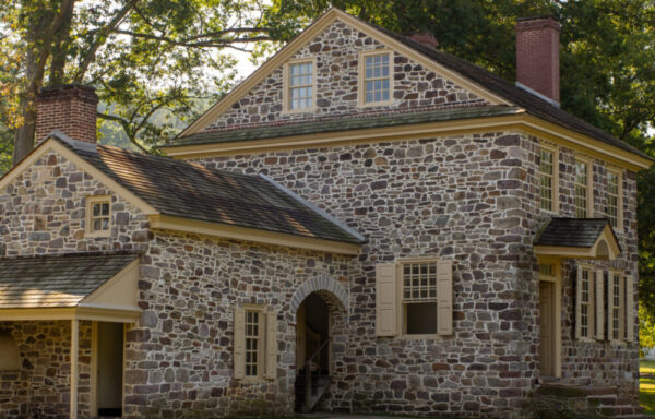
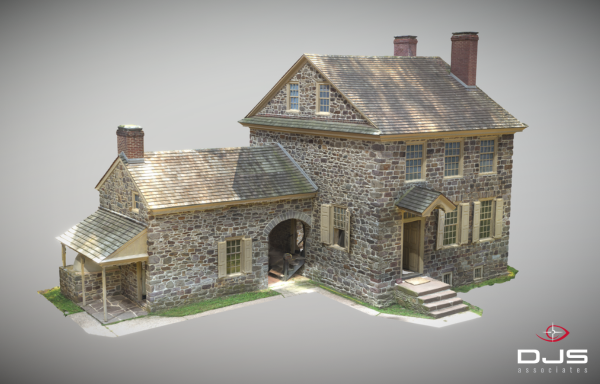
As the United States commemorates its 250th anniversary in 2026, there is perhaps no better time to reflect on the places that shaped the nation’s history and the technologies that can help preserve those places for future generations. Last year, DJS Associates, Inc. had the opportunity to utilize photogrammetry techniques generally applied to forensic cases to generate a 3D model of one of America’s most significant historic structures: George Washington’s Headquarters at Valley Forge National Historical Park.
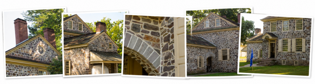
Photogrammetry involves taking hundreds, if not thousands, of overlapping photographs and using specialized software to reconstruct a highly detailed three-dimensional representation of an object, structure, or landscape. In many ways, photogrammetry allows a computer to do what our brains do naturally: identify common points from multiple viewpoints and use those relationships to understand shape and depth.
Over the course of one day, a dataset consisting of 1,379 photographs was created. The overlapping photographs were processed and converted into dense point clouds, textured meshes, and accurate three-dimensional models.
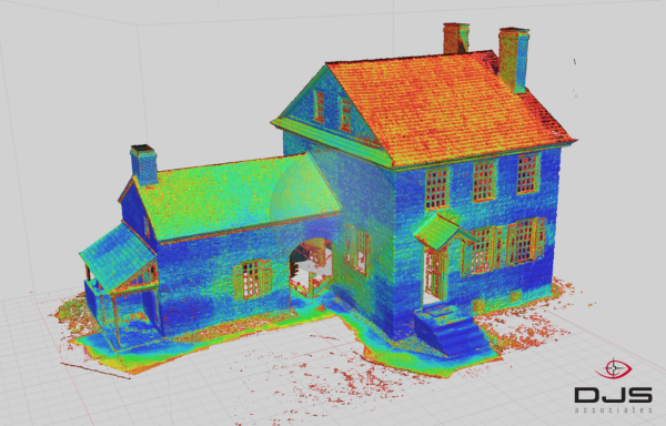
The final dense point cloud contained nearly 500 million points, producing an extraordinarily detailed digital representation of the building. From that dataset, a mesh consisting of more than 100 million polygons was generated. At that level of detail, individual architectural features, stone textures, and subtle construction characteristics become visible and measurable in ways that would be difficult to achieve through traditional photography alone.
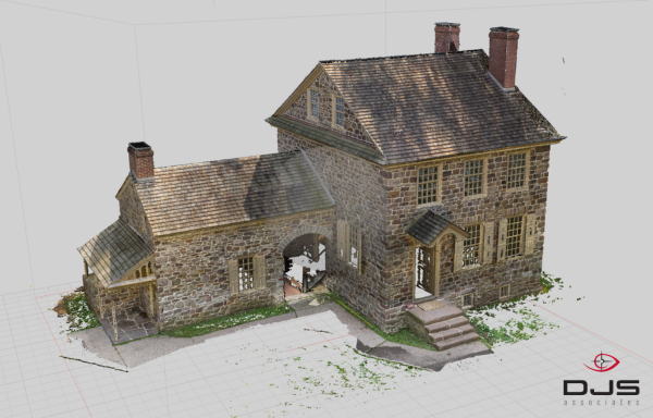
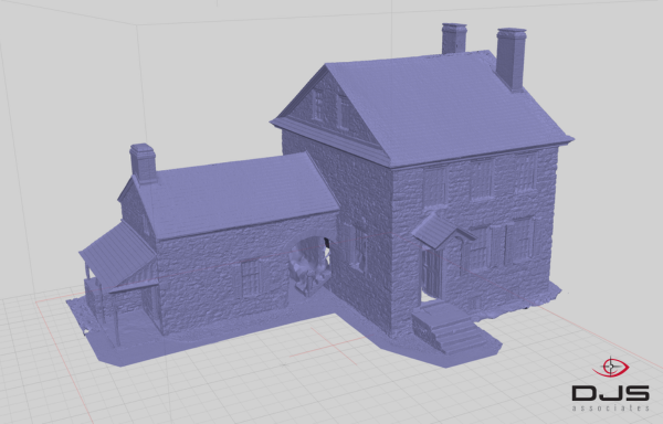
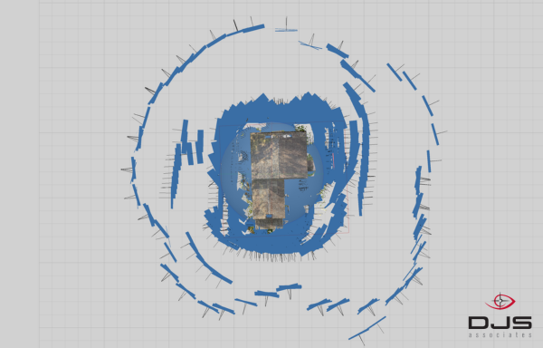
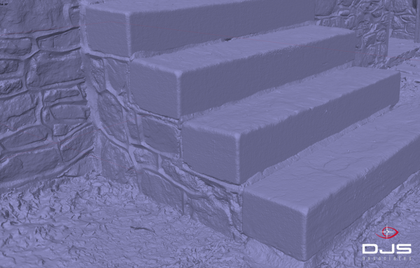
An optimized version was created and published on Sketchfab, an online platform that allows users to explore interactive 3D models through a web browser. The resulting model (embedded below) can be studied from virtually any perspective, providing an experience that bridges the gap between photography and physical inspection.
This exercise was intended to refine and demonstrate a pure photogrammetric workflow. Modern reality-capture projects often benefit from sensor fusion, or the integration of multiple complementary data sources into a single model. In forensic reconstruction work, the experts at DJS routinely integrate photogrammetry, aerial imagery, and terrestrial LiDAR data into unified models. The same principles apply whether documenting a transportation accident, an industrial incident, a building collapse, or a historic structure. The objective is always to preserve reality as completely and accurately as possible, allowing investigators, engineers, attorneys, and other stakeholders to revisit the scene long after conditions have changed.
While projects such as this naturally support historical preservation efforts, the underlying methodology has applications far beyond cultural heritage; significant parallels between documenting historic structures and documenting incident scenes are evident. High-resolution photogrammetry creates a permanent digital record that can be revisited long after the physical scene has changed or disappeared. Measurements can be extracted, conditions reviewed, and observations verified without requiring repeated site visits.
Preserving America ’s history is about more than protecting buildings. It is about preserving knowledge, context, and the stories embodied within those places. Technologies such as photogrammetry allow us to capture those stories with remarkable accuracy while making them more accessible to broader audiences than ever before.
George Washington would likely be astonished if he were somehow able to see a 500-million-point digital reconstruction of his headquarters floating around the internet. Then again, a man who successfully coordinated a revolution might simply view it as another example of adapting new tools to meet new challenges; a lesson that remains just as relevant today as it was in 1776.
Laurence R. Penn, CFVT
Senior Forensic Animation / Video Specialist
View all articles by Laurence R. Penn, CFVT